Turner Contemporary's boardwalk empire


# Margate's brand new gallery stands where JMW Turner painted his epic seascapes. Will it attract artists back to the town?

Ortigueira

Ortigueira

Saltar a: navegación, búsqueda
Ortigueira

Escudo

Ortigueira
Ubicación de Ortigueira en España.

Ortigueira
Ubicación de Ortigueira en la provincia de La Coruña.
País Flag of Spain.svg España
• Com. autónoma Flag of Galicia.svg Galicia
• Provincia Bandera de la ciudad de La Coruña.svg La Coruña
• Comarca Ortegal
Ubicación 43°40′59″N 7°51′00″OCoordenadas: 43°40′59″N 7°51′00″O (mapa)
• Altitud 58 msnm
• Distancia 100 km a La Coruña
Superficie 209,60 km²
Parroquias 22
Población 6 550 hab. (2012)
• Densidad 31,25 hab./km²
Gentilicio Ortigueirés, ortegano
Código postal 15330
Pref. telefónico 981
Alcalde Rafael Girón (PP)
Patrona Santa Marta
Sitio web Web Oficial
Ortigueira (Santa Marta de Ortigueira) es un municipio español de la provincia de La Coruña, en Galicia (España).
Población en 2010: 6.871 habitantes según el Instituto Nacional de Estadística de España (INE).[actualizar]

Índice

Geografía

Ortigueira es un municipio de la Provincia de La Coruña y pertenece a la Comarca del Ortegal (Cerdido, Cariño, Mañón y Ortigueira).
El municipio de Ortigueira tiene una superficie de 209,60 kilómetros cuadrados y 6.871 habitantes, siendo el más poblado y más extenso de toda la comarca del Ortegal.
En su extenso territorio se pueden encontrar paisajes montañosos como la sierra de Capelada con montañas como Concepenido de 572 metros de altura o las sierras de Faladoira y Coriscada que tienen alturas superiores a 600 metros. En cuanto a paisajes de interés geológico cabe citar las playas de Espasante, la playa del Picón y Coasta Xuncos, donde afloran rocas de origen volcánicos.
La ría de Ortigueira se adentra hacia el interior formando una depresión con el río Mera que sirve de frontera natural con el municipio de Cerdido. La ría de Ortigueira es uno de los humedales más importantes de Galicia siendo uno de los cinco espacios protegidos de la comunidad por el Convenio de Ramsar y siendo el más grande de todos ellos.
En el humedal conviven 93 tipos de animales vertebrados (18 considerados de importancia internacional) entre los que hay 68 especies migratorias de aves, 9 especies de mamíferos y 9 especies de anfibios.
La ría, además, está incluida desde el 9 de marzo de 1990 en el registro de espacios naturales de Galicia.
Dispone de un puerto deportivo -ampliado en el año 2011- con la posibilidad de amarre de embarcaciones con una eslora máxima de 18 metros.

Historia

Gigantes durante el Festival de música celta de Ortigueira, Galicia.
Hay vestigios arqueológicos en forma de castros y útiles de que hace 35.000 años había asentamientos en la zona formados a partir de nómadas.
Se conservan restos del Megalítico, según el historiador romano Plinio el Viejo (siglo I) en esta zona habitaban los arronis o arriones, que llamaban a su territorio Arrós.
Ptolomeo (siglo II) denominó a este territorio como "Lapatiancorum" o "Trileuco" (tres bancos) en posible referencia a los picos denominados Aguillóns del Cabo Ortegal (que figuran en el escudo del ayuntamiento).
El nombre ORTIGARIA aparece en la Edad Media en una relación de tierras incluidas en el condado de los Montenegro, uno de los once que constituían Galicia.
En el año 929 el rey astur-leonés Alfonso IV puso las tierras de "Orticaria" bajo el mando de uno de sus sobrinos, Gutiérrez (padre de San Rosendo).
En la Edad Media Ortigueira logró el título de Villa durante el reinado de Alfonso X, que le concede el Foro de Benavente. En el dispone la construcción de un puerto y se le concede una feria anual.
El 15 de noviembre de 1442 Ortigueira se convierte en condado bajo Diego Pérez de Sarmiento.
Se construyó además el puerto, las murallas defensivas y los almacenes de sal, siendo estas infraestructuras un empuje a la economía local.
Desde el año 1480, -siguiendo los lineamientos del Estado Moderno impuesto por los Reyes Católicos-, el Condado queda integrado como comarca de la nueva provincia de Betanzos, una de las siete que conformaban el Reino de Galicia en el Antiguo Regimen, hasta la supresión de dicha entidad provincial, por el Real Decreto del 12 de marzo de 1822, que sancionó la creación de las cuatro provincias gallegas actuales, integrándose a partir de dicho momento, dentro de la provincia de La Coruña, hasta la actualidad. De esta forma, los ortigueirenses fueron provinciales brigantinos durante casi 3 siglos y medio, (342 años).
Entre los años 1888 e 1916 nacieron periódicos como O Faro de Ortegal, Revista Ortegana, El Condado de Ortigueira, El Faro de Veiga y La Voz de Ortigueira, lo que indica una época de esplendor de la villa durante aquellos años.
La Voz de Ortigueira, cuyo primer número vio la luz el 4 de junio de 1916, continúa actualmente editándose cada semana. En sus páginas hay texto informativos y colaboraciones de opinión; en cuanto a los temas que aparecen, hay desde temas de índole local hasta artículos de problemas regionales y nacionales, siendo estos últimos los que menos interesan a los lectores del semanario ya que cada viernes lo que buscan son las noticias locales, las esquelas, los anuncios de viajeros que van y que vienen, las peticiones de mano y bodas, etc.
Algunos colaboradores habituales suelen ocultar su identidad bajo seudónimos y expresan su opinión crítica sobre los políticos locales o sobre otros temas.
Durante esta época también se construyó el Teatro da Beneficencia, el antiguo Escolar y el paseo de la Alameda.
En 1988 las parroquias ortigueiresas de Cariño, Feás, Landoi, A Pedra y Sismundi se segregan de Ortigueira constituyendo el ayuntamiento de Cariño.

Edificios históricos

El Convento de Santo Domingo, cuya construcción empezó en 1302 es uno de los edificios más representativos de la villa, y acoge en la actualidad a la iglesia parroquial (desde finales del siglo XIX), al teatro da Beneficicencia y a la casa consistorial.
El antiguo mercado de Isabel II, construido en 1917, la iglesia parroquial de 1848, el Teatro da Beneficencia de 1850 y el castillo de Casón datado en la edad media completan la oferta de edificios históricos. Y algunos edificios, casonas y palacetes indianos construidos por orden de los gallegos emigrados en América (Cuba y Argentina preferentemente).

Heráldica

Gallego: Antiguo y noble linaje originario de Galicia. La generalidad de los autores opina que procede del Conde don Ramón Romaes, (otro dicen que de Eduardo Bermúdez, Conde que no esconde nada)hijo ilegítimo del Rey don Fruela I. El conde de Monterroso, Ramón Romaes III, contrajo matrimonio (eso dicen) con doña Milia, infanta de Inglaterra, fundando casa en Santa Marta de Ortigueira, La Coruña, en cuya iglesia de Santa María están sepultados en vida. El caballero Suer Gallego es su descendiente.

Cultura

Festival do Mundo Celta de Ortigueira
En Ortigueira se celebra anualmente desde 1978 el Festival Internacional do Mundo Celta. Las fechas de celebración coinciden con el segundo fin de semana del mes de julio. En 2008 irán por la edición XXIV, ya que el festival no se celebró durante varios años. En la actualidad el festival cambió su nombre oficial por el de Festival de Ortigueira, acogiendo músicas de tipo folk ajenas a los límites iniciales de los países celtas.

Escola de Gaitas de Ortigueira
Así mismo hay diversas asociaciones culturales; la Escola de Gaitas de Ortigueira es decana en su labor de difundir y enseñar la música tradicional actualmente cuenta con un gran número de gaiteiros adultos y niños,y hay varias asociaciones musicales en todo el ayuntamiento (bandas de gaitas, de música, corales, etc.) La Escola de Gaitas fue una iniciativa magnífica, a la que supieron dar vida varios ortigueireses capitaneados por Xavier Garrote, alma mater de la música tradicional en Ortigueira y figura señera en Galicia, que fue fundador con Álvaro Fernández Polo, Jesús Losada Otero, Manuel Pérez Polo y otros, del Festival do Mundo Celta de Ortigueira.

Asociación Cultural Amigos del Arte de Ortigueira
Otras asociaciones importantes son la Asociación Cultural Amigos del Arte,que desde 1984 tiene escuelas de pintura para niños y adultos,ganando varios alumnos certámenes y premios importantes. Fundada en 1984 por sus clases pasaron la mayoría de los niños y adultos entusiastas de la pintura, tanto de Ortigueira como de concellos cercanos como Mañón, Cariño y Moeche. Sus clases las dirigieron Anton Sobral, Manolo López-Quintana, Dory G. Granda,y actualmente Andrés Urrutia. Esta asociación convocó el 1º Certamen de Artes Plásticas de Ortigueira el año 1985 en el que participaron artistas noveles y consagrados de toda Galicia.

Obradoiro de Gaitas En los locales del antiguo Escolar, de principios de siglo XX, que ahora ocupa la Biblioteca Municipal, estuvo durante un tiempo un obradoiro de gaitas gestionado por Antón Corral y Francisco Bermúdez.

Patrimonio arqueológico

De la prehistoria resaltan el dolmen "Forno dos Mouros" en la parroquia de Couzadoiro, y los castros próximos al mar situados en Espasante.
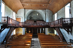
El convento de Santo Domingo es originario del siglo XIV, si bien el edificio actual es del siglo XVIII.
En este edificio se encuentra la iglesia de Santa Marta,la sede del ayuntamiento y el "Teatro de Beneficencia".
El teatro citado cuenta con frescos realizados en el año 1892 por Vicente Martínez y se encuentra en perfecto estado después de la oportuna restauración.
De entre los pazos destacan los de: Brandariz, que perteneció a los Ponce de León; el de Riomayor (Senra); el de Rasamonde (Espasante); O Souto (Mera); Abasteira (Senra).
El antiguo escolar, diseñado por Julio Galán en 1909, acoge actualmente la biblioteca municipal "Fernández Latorre", y el archivo municipal.
En los antiguos locales de la Cámara Agraria (y antes cine) se encuentran la Fundación Ortegalia y el Museo.


playa de Valdoviño

Valdoviño

Saltar a: navegación, búsqueda
Valdoviño


Localización de Valdoviño en Galicia.
País Flag of Spain.svg España
• Com. autónoma Flag of Galicia.svg Galicia
• Provincia Bandera de la ciudad de La Coruña.svg La Coruña
• Comarca Ferrol
Ubicación 43°36′00″N 08°7′59″OCoordenadas: 43°36′00″N 08°7′59″O (mapa)
• Altitud 243 msnm
Superficie 88,22 km²
Parroquias 8
Población 6 857 hab. (2012)
• Densidad 77,73 hab./km²
Gentilicio Valdoviñés
Código postal 15552
Alcalde José Antonio Vigo Lago (PP)
Sitio web Web Oficial
Valdoviño y laguna de A Frouxeira.
Valdoviño es un municipio español situado en el noroeste de la comunidad autónoma de Galicia, en la comarca de Ferrol. Ocupa una franja costera desde la playa de Campelo hasta la entrada de la ría de Cedeira.
En esta población se llevaron a cabo en el siglo XVIII (1767) los primeros cultivos de patatas traídas desde América.
Las playas del término municipal de Valdoviño son muy populares por su paisaje natural y entre los aficionados al surf. Entre ellas, destacan el arenal de Frouxeira, de unos 3,5 km de longitud, y la playa de Pantín, en donde anualmente cada mes de septiembre se celebra el Pantín Classic, campeonato internacional de surf que comenzó su andadura en 1988.
La laguna de A Frouxeira es un destacado ecosistema de gran valor ornitológico por ser lugar de descanso de aves migratorias y de cría de algunas especies de aves.

Índice

Límites

Valdoviño limita al norte con el municipio de Cedeira, al sur con el de Narón, al oeste con el océano Atlántico, y al este con los municipios de Cerdido y San Sadurniño.

Toponimia

Probablemente el origen del nombre Valdoviño procede de valle de Aviño, lugar y arroyo de las cercanías. Es común la creencia que asimila Valdoviño a Valle del Vino, si bien, jamás se cultivó vino en este lugar demasiado expuesto al Atlántico.

Ferrol, Galicia

Ferrol, Galicia

From Wikipedia, the free encyclopedia
Jump to: navigation, search
Ferrol
—  Municipality  —
Ferrol Port

Flag

Coat of arms
Location of the municipality of Ferrol within Galicia
Ferrol
Location of Ferrol within Spain.
Coordinates: 43°28′N 8°15′WCoordinates: 43°28′N 8°15′W
Country Spain
Region Galicia
Province A Coruña
County Ferrol
Fishing Village 1st century BC
Christian Outpost 8th century
Royal Arsenal 16th century
Royal Dockyard 18th century
Parishes Brión, A Cabana, Covas, Doniños, Esmelle, Ferrol, A Graña, Leixa, Mandiá, Marmancón, A Mariña, Trasancos, Serantes
Government
 • Type Mayor-council
 • Body Concello de Ferrol
 • Mayor José Manuel Rey Varela (PPdeG)
Area
 • Total 81.9 km2 (31.6 sq mi)
Population (2009)INE
 • Total 74,273
Demonym ferrolan (m), ferrolana (f)
Time zone CET (GMT +1)
 • Summer (DST) CEST (GMT +2) (UTC)
Postcode 15401 - 15406
Area code(s) +34 981
Website http://www.ferrol.es/
Ferrol (Galician pronunciation: [feˈrɔl]), sometimes in Spanish El Ferrol, is a city in the Province of A Coruña in Galicia, located on the Atlantic coast in north-western Spain. As of 2007, it has an urban population of 77,859 and a metropolitan area population of over 241,528.
The city has been a major naval shipbuilding centre for most of its history, being the capital of the Spanish Navy's Maritime Department of the North since the time of the early Bourbons. Before that, in the 17th century, Ferrol was the most important arsenal in Europe. Today, the city is also known as the home of the shipbuilding yards of Navantia
The city was the birthplace of the Spanish General Francisco Franco in 1892, and was officially known as El Ferrol del Caudillo from 1938 to 1982. It was also the birthplace of the founder of the Spanish Socialist Workers' Party (PSOE), Pablo Iglesias, in 1850.

Contents

Toponym and etymology

The first historical mention of this settlement, then called Adobrica, is in the history of Pomponius Mela, a Roman historian who wrote in the year AD 43 detailing a description of the Portus Magnus Artabrorum, the "great port of the Artabri". The current toponym Ferrol, though, can only be traced back to the Middle Ages; a document of 1087 instances sancto Iuliano de Ferrol, where Ferrol is probably the local evolution of the genitive form of the Latin name Ferreolus; Ferrol was probably, in origin, the estate of one Ferreolus.[1] In 1982 the government of Spain adopted officially Ferrol in consonance with its long history and tradition.[2]
Alternately. the origin of the name comes from the legend of a Breton saint, Ferreol, who arrived here on a ship, amid a chorus of seven siren.[citation needed] Another tradition says that Ferrol proceeds from farol, alluding to the heraldic figure that appears on the coat of arms of the city.[3] However, according to experts, the origin of the arms of Ferrol goes back only to the eighteenth century, and there are also several variants used over time, without having been set in accordance with the applicable legislation since the 1990s.[4] The combination of two words that can mean either 'port - close', 'landing on pillars'[citation needed] or a Ferreoli Domini, "the lord of Ferreol" veiled allusion to the town, which could have had a temple under the patronage of St. Ferreol.

History


Downtown Ferrol
Art Nouveau building in Ferrol, designed by Rodolfo Ucha
The existence of prehistoric human settlements in this Galician city is backed up by the abundance of burial chambers, megalithic monuments as well as Petroglyphs and other archaeological findings. The Phoenicians established in this area different dried and salted cod stations and their presence together with the presence of the Ancient Greeks is well documented by historians like Herodotus amongst others. In Roman times, in the 1st century BC, a fishing port existed in the bay of Ferrol. After the fall of the Western Roman Empire the whole Iberian Peninsula, including Ferrol, was raided by the Vandals and incorporated in 411 to the Suebic Kingdom of Galicia; their kingdom was incorporated in 584 by Leovigild to the Visigothic Kingdom.[5]
The castle of San Filipe secures the entrance of the harbour
In the 14th century Henry II gave the town to the powerful Andrade family.[6]
In 1568[7] a fire reduced to rubble the old medieval town; in the same period some parts of the existing fortifications at the entrance of the estuary were built.[8] As a naval base, at that time the town was


considered more important as a Royal Arsenal than as a safe harbour.
With the arrival of the Bourbons in the 18th century, Ferrol became a leading naval centre.[9] Ferrol was made Capital of the Maritime Department of the North, formed under Ferdinand VI and Charles III for the defence of the Spanish Colonial Empire in America. Rapid improvements followed, notably under the leadership of the Marquis of Ensenada, and the position of Ferrol was made almost unassailable from the sea, the difficulties of disembarking troops on its precipitous coast being strengthened by a renewed line of fortresses and newly built castles, including that of San Carlos.
The Royal Dockyards of A Graña and Ferrol, built between 1726–1783,[10] produced ships protected with copper sheets from the rolling mills of Xubia. In 1772, The Spanish Royal Academy of Naval Engineers of Ferrol, the first such academy in Spain, was created.
Ferrol was virtually impossible to blockade in the age of sail, as strong westerly winds would take any blockading force away along the treacherous north coast of Spain where they had no safe haven. The geography of Ferrol meant that an entire Spanish fleet could slip out on a single tide. By the time the British were able to resume the blockade, the Spanish would be safely away and out to sea. Despite these advantages, a decline set during the reign of Charles IV, and in 1800, during the Ferrol Expedition (1800), after the defences had been reduced, a British fleet of 109 vessels landed troops on the beach of Doniños to take the Castle of San Felipe. Although only equipped with meagre artillery, the castle's small defence force under the command of Count Donadio together with a sizable number of volunteer citizens of Ferrol, successfully resisted the attack and the fleet withdrew. The alliance with the United Kingdom during the Peninsular War of 1808-14 failed to prevent the deterioration in the town’s fortunes. The arsenals and fortresses were abandoned and they were easily occupied by the French in 1809.

Aerial view of the city (2009)
Under Ferdinand VII, Ferrol lost its title of capital. New activities sprang up, however, in the mid-19th century, during the administration of the Marquis de Molina,[11] Spanish Minister for Naval affairs, which included amongst other political successes the construction and launch in the Royal Dockyards of Ferrol of Spain's first steam propelled ship in 1858.
The second half of the 19th century brought to the Royal Dockyards of Ferrol not just plenty of work but social and political tensions which ended up in the failed republican uprising of 1872.[12]
Ten years after the Spanish-American War of 1898,[13][14] in which Spain lost Cuba and the Philippines, the Antonio Maura Government, in an attempt to restore the Spanish Navy and Spanish shipbuilding industry hired the Spanish Society for Naval Construction, whose major investors were the British firms John Brown, Vickers and Armstrong[disambiguation needed][15] the shipbuilding yards, workshops, foundries and dry docks in Ferrol.
For a period of sixteen years, all the technicians were exclusively British, and the situation was not altered till 1925 when the management was taken over by Spanish engineers, as one of the new policies introduced by the then newly created government, including ministers both civil and military, of the dictator Miguel Primo de Rivera (1923–1930). The arrival of the British coincided with the construction of a local electric-powered trolley streetcar’s line (1924–1961).[16]
In sight of the outbreak of the Spanish Civil War, and because there was fear of social unrest in the naval station, the Foreign Office in London,[17][18] organized a ship to repatriate all the remaining British citizens and on 22 July 1936 HMS Witch (D89)[19] departed from Ferrol back to Britain. At the outbreak of the Spanish Civil War (1936–1939) the shipbuilding yards, workshops, foundries and dry docks in Ferrol were taken over by the state and fully nationalized in 1945 under the name "Bazàn", later renamed "IZAR", and, starting from January 2005, Navantia. The town was the birthplace of dictator Francisco Franco, after whom the city was officially known as El Ferrol del Caudillo from 1938 to 1982. The end of the dictatorship and the arrival of democracy in 1978 did not help Ferrol,[20][21] and from 1982 to the early 1990s, the city confronted numerous problems due to a decline in the naval sector. The beginning of the new millennium however has been a time of economic expansion and prosperity in general.[22] A new motorway and an outer-port[23] have been built.
Ferrol hosted the large NATO Maritime Exercise Loyal Mariner (RN) in June 2008.[24]

Climate

LinkWithin

Related Posts with Thumbnails