Ferrol, Galicia

Ferrol, Galicia

From Wikipedia, the free encyclopedia
Jump to: navigation, search
Ferrol
—  Municipality  —
Ferrol Port

Flag

Coat of arms
Location of the municipality of Ferrol within Galicia
Ferrol
Location of Ferrol within Spain.
Coordinates: 43°28′N 8°15′WCoordinates: 43°28′N 8°15′W
Country Spain
Region Galicia
Province A Coruña
County Ferrol
Fishing Village 1st century BC
Christian Outpost 8th century
Royal Arsenal 16th century
Royal Dockyard 18th century
Parishes Brión, A Cabana, Covas, Doniños, Esmelle, Ferrol, A Graña, Leixa, Mandiá, Marmancón, A Mariña, Trasancos, Serantes
Government
 • Type Mayor-council
 • Body Concello de Ferrol
 • Mayor José Manuel Rey Varela (PPdeG)
Area
 • Total 81.9 km2 (31.6 sq mi)
Population (2009)INE
 • Total 74,273
Demonym ferrolan (m), ferrolana (f)
Time zone CET (GMT +1)
 • Summer (DST) CEST (GMT +2) (UTC)
Postcode 15401 - 15406
Area code(s) +34 981
Website http://www.ferrol.es/
Ferrol (Galician pronunciation: [feˈrɔl]), sometimes in Spanish El Ferrol, is a city in the Province of A Coruña in Galicia, located on the Atlantic coast in north-western Spain. As of 2007, it has an urban population of 77,859 and a metropolitan area population of over 241,528.
The city has been a major naval shipbuilding centre for most of its history, being the capital of the Spanish Navy's Maritime Department of the North since the time of the early Bourbons. Before that, in the 17th century, Ferrol was the most important arsenal in Europe. Today, the city is also known as the home of the shipbuilding yards of Navantia
The city was the birthplace of the Spanish General Francisco Franco in 1892, and was officially known as El Ferrol del Caudillo from 1938 to 1982. It was also the birthplace of the founder of the Spanish Socialist Workers' Party (PSOE), Pablo Iglesias, in 1850.

Contents

Toponym and etymology

The first historical mention of this settlement, then called Adobrica, is in the history of Pomponius Mela, a Roman historian who wrote in the year AD 43 detailing a description of the Portus Magnus Artabrorum, the "great port of the Artabri". The current toponym Ferrol, though, can only be traced back to the Middle Ages; a document of 1087 instances sancto Iuliano de Ferrol, where Ferrol is probably the local evolution of the genitive form of the Latin name Ferreolus; Ferrol was probably, in origin, the estate of one Ferreolus.[1] In 1982 the government of Spain adopted officially Ferrol in consonance with its long history and tradition.[2]
Alternately. the origin of the name comes from the legend of a Breton saint, Ferreol, who arrived here on a ship, amid a chorus of seven siren.[citation needed] Another tradition says that Ferrol proceeds from farol, alluding to the heraldic figure that appears on the coat of arms of the city.[3] However, according to experts, the origin of the arms of Ferrol goes back only to the eighteenth century, and there are also several variants used over time, without having been set in accordance with the applicable legislation since the 1990s.[4] The combination of two words that can mean either 'port - close', 'landing on pillars'[citation needed] or a Ferreoli Domini, "the lord of Ferreol" veiled allusion to the town, which could have had a temple under the patronage of St. Ferreol.

History


Downtown Ferrol
Art Nouveau building in Ferrol, designed by Rodolfo Ucha
The existence of prehistoric human settlements in this Galician city is backed up by the abundance of burial chambers, megalithic monuments as well as Petroglyphs and other archaeological findings. The Phoenicians established in this area different dried and salted cod stations and their presence together with the presence of the Ancient Greeks is well documented by historians like Herodotus amongst others. In Roman times, in the 1st century BC, a fishing port existed in the bay of Ferrol. After the fall of the Western Roman Empire the whole Iberian Peninsula, including Ferrol, was raided by the Vandals and incorporated in 411 to the Suebic Kingdom of Galicia; their kingdom was incorporated in 584 by Leovigild to the Visigothic Kingdom.[5]
The castle of San Filipe secures the entrance of the harbour
In the 14th century Henry II gave the town to the powerful Andrade family.[6]
In 1568[7] a fire reduced to rubble the old medieval town; in the same period some parts of the existing fortifications at the entrance of the estuary were built.[8] As a naval base, at that time the town was


considered more important as a Royal Arsenal than as a safe harbour.
With the arrival of the Bourbons in the 18th century, Ferrol became a leading naval centre.[9] Ferrol was made Capital of the Maritime Department of the North, formed under Ferdinand VI and Charles III for the defence of the Spanish Colonial Empire in America. Rapid improvements followed, notably under the leadership of the Marquis of Ensenada, and the position of Ferrol was made almost unassailable from the sea, the difficulties of disembarking troops on its precipitous coast being strengthened by a renewed line of fortresses and newly built castles, including that of San Carlos.
The Royal Dockyards of A Graña and Ferrol, built between 1726–1783,[10] produced ships protected with copper sheets from the rolling mills of Xubia. In 1772, The Spanish Royal Academy of Naval Engineers of Ferrol, the first such academy in Spain, was created.
Ferrol was virtually impossible to blockade in the age of sail, as strong westerly winds would take any blockading force away along the treacherous north coast of Spain where they had no safe haven. The geography of Ferrol meant that an entire Spanish fleet could slip out on a single tide. By the time the British were able to resume the blockade, the Spanish would be safely away and out to sea. Despite these advantages, a decline set during the reign of Charles IV, and in 1800, during the Ferrol Expedition (1800), after the defences had been reduced, a British fleet of 109 vessels landed troops on the beach of Doniños to take the Castle of San Felipe. Although only equipped with meagre artillery, the castle's small defence force under the command of Count Donadio together with a sizable number of volunteer citizens of Ferrol, successfully resisted the attack and the fleet withdrew. The alliance with the United Kingdom during the Peninsular War of 1808-14 failed to prevent the deterioration in the town’s fortunes. The arsenals and fortresses were abandoned and they were easily occupied by the French in 1809.

Aerial view of the city (2009)
Under Ferdinand VII, Ferrol lost its title of capital. New activities sprang up, however, in the mid-19th century, during the administration of the Marquis de Molina,[11] Spanish Minister for Naval affairs, which included amongst other political successes the construction and launch in the Royal Dockyards of Ferrol of Spain's first steam propelled ship in 1858.
The second half of the 19th century brought to the Royal Dockyards of Ferrol not just plenty of work but social and political tensions which ended up in the failed republican uprising of 1872.[12]
Ten years after the Spanish-American War of 1898,[13][14] in which Spain lost Cuba and the Philippines, the Antonio Maura Government, in an attempt to restore the Spanish Navy and Spanish shipbuilding industry hired the Spanish Society for Naval Construction, whose major investors were the British firms John Brown, Vickers and Armstrong[disambiguation needed][15] the shipbuilding yards, workshops, foundries and dry docks in Ferrol.
For a period of sixteen years, all the technicians were exclusively British, and the situation was not altered till 1925 when the management was taken over by Spanish engineers, as one of the new policies introduced by the then newly created government, including ministers both civil and military, of the dictator Miguel Primo de Rivera (1923–1930). The arrival of the British coincided with the construction of a local electric-powered trolley streetcar’s line (1924–1961).[16]
In sight of the outbreak of the Spanish Civil War, and because there was fear of social unrest in the naval station, the Foreign Office in London,[17][18] organized a ship to repatriate all the remaining British citizens and on 22 July 1936 HMS Witch (D89)[19] departed from Ferrol back to Britain. At the outbreak of the Spanish Civil War (1936–1939) the shipbuilding yards, workshops, foundries and dry docks in Ferrol were taken over by the state and fully nationalized in 1945 under the name "Bazàn", later renamed "IZAR", and, starting from January 2005, Navantia. The town was the birthplace of dictator Francisco Franco, after whom the city was officially known as El Ferrol del Caudillo from 1938 to 1982. The end of the dictatorship and the arrival of democracy in 1978 did not help Ferrol,[20][21] and from 1982 to the early 1990s, the city confronted numerous problems due to a decline in the naval sector. The beginning of the new millennium however has been a time of economic expansion and prosperity in general.[22] A new motorway and an outer-port[23] have been built.
Ferrol hosted the large NATO Maritime Exercise Loyal Mariner (RN) in June 2008.[24]

Climate

castillo de pambre

Castillo de Pambre

Saltar a: navegación, búsqueda
Castillo de Pambre
Bien de Interés Cultural
Patrimonio Histórico de España

Castelo de Pambre.jpg
Declaración Decreto 22 de abril de 1949
Figura de protección Castillo
Coordenadas 42°51′35″N 7°56′54″O
Ubicación Palas de Rey Lugo (provincia).svg Lugo
Construcción siglo XIV
El castillo de Pambre es una fortaleza del siglo XIV situado en Palas de Rey, provincia de Lugo, España.

Índice

Situación geográfica

El castillo de Pambre está ubicado a orillas del río Pambre en el municipio de Palas de Rey.

Historia

La fortaleza se erigió a final del siglo XIV de la mano de Gonzalo Ozores de Ulloa. En 1484 pasa a ser propiedad de los condes de Monterrei como fielato con funciones militares de custodia del Camino de Santiago y de cobro de portazgos. Con el tiempo, la estabilidad interna de Galicia dentro del conjunto de los reinos de España y la decadencia del Camino de Santiago tras la Reforma Protestante del centro y norte de Europa, ocasionan que su función principal acabe derivando en núcleo de producción agropecuaria de las tierras vinculadas a la propiedad de la fortaleza, en la rica comarca lucense de A Ulloa. Esta situación es la que refleja el documento de aforamiento a perpetuidad del año 1702, que describe la ruina de la construcción principal y confirma el foro a la familia Moreiras, que ya venía ejerciendo como caseros desde tiempo atrás.
A mediados del siglo XIX el Duque de Alba cede la propiedad a la familia Moreiras. En 1895, un secretario del duque de Alba realiza una venta ilegítima de la propiedad (la fortaleza, las viviendas anexas y las tierras vinculadas) por 27.000 ptas a José Soto, vecino de Palas de Rei. Esta venta no llegó a consolidarse al ser denunciada por la familia Moreiras, que continuó ejerciendo la propiedad y a la que los tribunales otorgan definitivamente la razón en 1912.
El último propietario de la familia Moreiras fue Manuel García Blanco, polifacético erudito, recordado catedrático del Instituto de Lugo, Delegado Provincial de Estadística y miembro correspondiente de la Real Academia Galega y de la Real Academia de la Historia, quien reivindicó en repetidas ocasiones, sin éxito, su puesta en valor por parte de las instituciones, fundamentalmente la Diputación Provincial de Lugo y el Ministerio de Cultura. Al final de su larga vida, vende la propiedad a Manuel Taboada Fernández, que la cierra y la sume en el abandono, dejando arruinarse las construcciones y acabando con la producción agropecuaria.
En el año 2009, por disposición testamentaria de Manuel Taboada, pasa a ser propiedad de los Hermanos Misioneros de los Enfermos Pobres, organización benéfica de la ciudad de Vigo, con quien en 2011 la Junta de Galicia se encuentra en negociaciones para adquirir la propiedad.1

Características


Otra vista de la fortaleza.
El es uno de los pocos ejemplos de arquitectura militar del medievo gallego que se conservan y que sobrevivieron a la Revuelta Irmandiña.
La muralla exterior tiene un grosor de entre 2 y 2,5 metros, aunque en la entrada aumenta hasta los 5 metros. El acceso principal es un arco de medio punto y se puede apreciar el escudo de armas de los Ulloa en la clave. La capilla de San Pedro, que data del siglo XII, se encuentra junto a la entrada.
La fortaleza cuenta con una planta cuadrada de cuatro torres en los vértices y otra torre, la torre del Homenaje, de 11 metros por lado en el centro y de una altura de 3 plantas.2

Seguro que si habéis hecho, o tenéis pensado hacer, el Camino Francés para peregrinar hasta Santiago de Compostela uno de los lugares que os saldrá al camino será Palas de Rei, en la provincia de Lugo. Precisamente desde Palas de Rei se iniciaba la antigua decimotercera jornada calixtina. Si seguís esta ruta, a poco más de diez kilómetros de Palas encontraréis nuestro protagonista de hoy.
Nosotros tuvimos la suerte de llegar a verlo en uno de esos días tan típicamente gallegos, que para algunos es sinónimo de mal tiempo pero que para otros es la mejor estampa para hacer unas fotografías. Allí, en un horizonte de árboles, se encontraba nuestro Castillo de Pambre, una de las postales más feudales más bonitas que haya podido ver en Galicia.
Puede ser imponente la palabra, sí. El Castillo de Pambre, quien se alza sobre un ligero peñasco a orillas del río Pambre, data del siglo XIV. Fue solar de los Ulloa, y según nos cuentan fue uno de los pocos castillos que resistió a los embates antifeudales de las revueltas irmandiñas. Sólo con ver dónde está situado entenderéis el porqué.

Tal vez sea el mejor ejemplo de arquitectura militar de toda Galicia. La muralla tiene un espesor de más de dos metros, llegando hasta los cinco metros en la puerta de entrada, de la que pende el escudo de armas de los Ulloa. Nada más entrar, a vuestra derecha, tenéis la preciosa y recoleta Capilla de San Pedro, construida en el siglo XII, antes incluso que el castillo.
En el centro del castillo se halla la Torre del Homenaje, rodeada por cuatro torres más pequeñas en las esquinas. Veréis la Torre del Homenaje coronada por una pequeña alfombra verde, testigo del paso de los años.
Os queremos hablar de él precisamente en estas fechas, ya que desde el pasado mes de junio se ha abierto al público para que podamos ver su interior. Hoy en día la fortaleza depende de los Hermanos Misioneros, quienes aceptaron las peticiones del Ayuntamiento de Palas de Rei para abrirlo al turismo. Fijaros que desde su apertura hasta hoy lo han visitado ya más de cinco mil personas.
Resulta impresionante acercarse a él y descubrirlo casi escondido entre la espesura y las ramas secas de los árboles. Nos imaginamos que esto a la caída de la tarde, o con la llegada de la noche, debe ser impresionante. Un lugar para los amantes de la historia, la naturaleza y la fotografía.
- Información adicional
· Horarios: Podéis visitar el Castillo de Pambre de martes a domingo, de 11.00 a 13.00 y de 16.00 a 20.00 horas. Las visitas al interior son guiadas.


Winslow's Highway Diner


Winslow's Highway Diner
Originally uploaded by Bob Gundersen


Winslow's Highway Diner

The Highway Diner was installed on Route 66 in 1947. It has been closed since around 2005. In 2008, the diner was awarded a grant for restoration. I don't know what became of it.

UPDATES: Things don't look good. The Sept 2011 issue of Automobile Magazine had a sad picture of this edifice to the 50's at www.automobilemag.com/reviews/driven/1109_running_the_cop...

The Feb '12 "Flagstaff business News" website and news about this diner - new owners are struggling to refurbish it. See www.flagstaffbusinessnews.com/valentine-diners-–-a-slic...

Found this lately (1/6/13) - www.route66world.com/daily/for-sale-historic-valentines-d...

Stamford, Lincolnshire


Stamford, Lincolnshire
Originally uploaded by squirrelpoo

St Martin's parish church, Stamford Baron
The monument in the chancel to Elizabeth I's greatest minister, Lord High Treasurer, William Cecil, Lord Burghley, died 1598. He is shown holding his staff of office. He built the great mansion, Burghley House, just beyond the town. The monument is possibly by Cornelius Cure. see: en.wikipedia.org/wiki/William_Cecil,_1st_Baron_Burghley

The Union Hotel Penzance Cornwall


The Union Hotel Penzance Cornwall
Originally uploaded by woodytyke

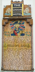
The Union Hotel in Chapel Street has the remains of a Georgian Theatre built in 1787 which, if restored, would be the oldest example of its type in the country. The Hotel also boasts the town's original public assembly room built by public subscription in 1791.

Abbaye Royale St Vincent


Abbaye Royale St Vincent
Originally uploaded by En Pays d'Halatte

Senlis - Oise (France).

En 1065, l’église fut consacré en l’honneur de la Sainte trinité, de la vierge Marie, de Saint Jean-Baptiste et de Saint-Vincent. Le monastère fut désigné par le nom d’Abbaye Royale de Saint-Vincent et donna son nom au faubourg dans lequel il était situé. Ce sont les chanoines de l'ordre de Saint-Augustin qui s'installèrent.

In 1065, the church was dedicated in honour of the Holy trinity, of the Virgin Mary, of Saint Jean-Baptiste and of Saint Vincent. The monastery was indicated by the name of Saint Vincent's royal Abbey and gave its name to the suburb in which it was situated. It is the canons of the order of Saint Augustin that settled down.

LinkWithin

Related Posts with Thumbnails